Customer login

We will e-mail you a sign-in link and a 6-digit code. No password needed.

FSM Ferienhaus

Vinica-Petrina-Osilnica

Vinica-Petrina-Osilnica is a cycle route (regional), about 105 km long. Along the way: Metlika, Križevska vas, Griblje, Vinica, Brod na Kupi and Kočičin.

Type:
Cycle route · regional
Number:
R20
Length:
approx. 105 km (one way)
Elevation gain:
↑ 1,350 m · ↓ 1,210 m · highest point 443 m
Places along the way:
Metlika · Križevska vas · Griblje · Vinica · Brod na Kupi · Kočičin

Profile

3D view

Elevation profile: ↑ 1,350 m · ↓ 1,210 m · highest point 443 m near HribElevation: EU-DEM v1.1, Copernicus Land Monitoring Service (European Union), retrieved via Open Topo Data; smoothed and calculated by us.

Data: © OpenStreetMap contributors

Nothing suitable? We will search for you.

Nothing suitable?

Tell us what matters to you — we will email you suitable properties. Your search: no details yet

Places to visit along Vinica-Petrina-Osilnica

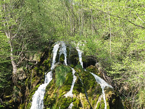
Photo: Ljuba brank at Slovenian Wikipedia · CC BY-SA 3.0 · Wikimedia Commons

Waterfall

Nežica

850 m from the route

Waterfall and stream in the Municipality of Kostel, Slovenia.

More cycling and hiking routes in Kvarner Bay

Hiking trail · regional

Camino Krk

approx. 157 km · ↑ 3,430 m · 2 of our homes nearby

Hiking trail · international

Camino Gorski Kotar

approx. 295 km · ↑ 6,730 m · 1 of our homes nearby

All places: Active & sport

FSM Ferienhaus

Entspannt buchen

Sie buchen direkt bei uns. Wir stimmen Ihre Buchung mit dem Vermieter ab und bestätigen sie Ihnen – erst dann zahlen Sie, bequem per Überweisung mit QR-Code. In Ihrem Kundenkonto sehen Sie jederzeit, wie weit Ihre Buchung ist.

FSM Ferienhaus

Entspannt reisen

Ihren Voucher und den Reiseführer zu Ihrem Haus finden Sie im Kundenkonto – auch unterwegs auf dem Handy. Und haben Sie vor oder während der Reise eine Frage, sind wir für Sie da.

FSM Ferienhaus

Entspannt erholen

Seit 2005 vermitteln wir Ferienhäuser in Kroatien und wählen jedes Haus sorgfältig aus. Zu jedem Haus zeigen wir Strände, Ausflugsziele und Radrouten in der Nähe – mit echten Wegen statt Luftlinie.